This account is about my adventures on the Western Way in 2016 on my mountain bike.
I have been involved with the Western way since its beginning sometime in 1993, route finding, mapping, writing a guidebook, and most importantly walking the trail and leading others along the way. My wife Pauline has also long been involved, and as recent as 2016 when we worked together on a set of walking guide notes to replace the old guide book, that guide is somewhat, though not completely out of date.
I begin the trip in Newport, just across the bridge by the map board. The distance to the Bothy in Srahmore is 13 kms a short trip for a road cyclist but on a mountain bike a different story. I should point out that I used slick tyres [not the ones in the picture though I use those tyres for the most part, due to the road elements I decided on the slicks. My bike is not state of the art, but comfortable and capable, a Giant. I carried all the necessary spares etc that a sensible rider would, especially for day two when I would be well away from civilisation on a few occasions.
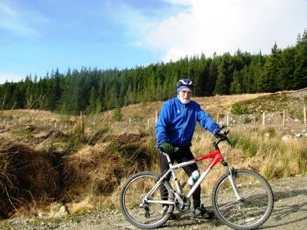
My Giant Mountain Bike has served me well
![]()
Above is a profile of the first section from Newport to Srahmore Bothy
The maximum height reached is 95 metres.
This is not a route finding guide, as I expect riders to get a copy of the gpx file from me before setting out. That way nobody will lose their way, something that is easy to do on this long journey, when concentration on the surface can distract from route finding.
So you pass through Newport and head out the N59 for a short 1.5 kms before turning north on the road to Srahmore. You are passing through the last remnants of the drumlin landscape that dominates the Western Way from Westport to Newport. A few pieces of sessile oak forest dot the drumlins; in fact the prefix Derry, meaning an oak wood, features in place names, names like Derrygarve and Derrintaggart. Sessile oak is apparently native to Ireland. The big lake that appears on your left is Furnace Lake and some people refer to the hills beyond as the wire hills; a link perhaps to iron workings, indeed Grace O Malleys husband was called Risteard an Iarainn, Iron Richard, perhaps a reference to his involvement in ironworking. He lived nearby in the 16th century.
After4.3 kms you leave the road and head up what locals call the rocky road, this is really the old 19th century road, and indeed much older still it may date back to early Celtic times. For now it is abandoned except for the sheep farmers and the walkers and now me the mountain biker. It is only 500 metres but testing, you may be walking your bike a bit. The views become quite stunning as you emerge from the Rocky Road above the Furnace Cross roads. You can now see Lough Feeagh to the North West, as you head across the high road above the lake. You are on the old road through Treanbeg, the newer 20th century one runs along the lake shore, and it features in my Keenagh Loop road cycle.
You can just about see the remains of Treanbeg national school to the right of the road before you come to the houses a few steps of the yard entrance remain. This was also the site of a battle during the civil war. In February 1923 Medical Officer Lieutenant McQuaid, brother of the future Archbishop John Charles McQuaid, was mortally wounded in the conflict at Treanbeg.
Below and jutting into the lake is a promontory fort, dating from the Iron Age, it has its own Chevaux de Friese, and a possible Viking house site. The Vikings would have travelled up through Lough Furnace and possibly settled here for winter. Only an archaeological dig will reveal the truth. Incidentally local people refer to it as a Diarmuid and Grainne resting place.
At 8 kilometres where the road turns and dips towards the lake the trail turns north on an old farm track, now you see why we are on a mountain bike. Buckoogh is the high mountain on your right. To the North West at the head of the lake is Glennamong the valley where recent bones were discovered by Michael chambers a local walker and historian. We await their dating that might link occupation of the area back to the Neolithic. The track eventually peters out and your gpx data will guide you along otherwise you will need to pay careful attention to the black waymarkers with the yellow walking man inscribed thereon. Some tricky navigation and walking with your bike will bring you to the tarmac road.
You follow this road to the entrance to the forest, the nice stone house is part of an old mill complex some of which is neglected, and it has long passed out of usage. The Srahreevagh River is crossed at the last farm house before entering the forest, I stress that this is the last farm house for many many kilometres. Another kilometre and you arrive at the Brogan Carroll Bothy, today it is called The Robert Lloyd Praeger Bothy, unfairly I believe, as the above Mayo men paid for this memorial to their ancestors, it should remain in their names I believe.
Anyhow you have now completed the first part of the journey, perhaps with the trickiest sections and the most off bike sections of the Western Way. You are ready to begin a real adventure as you travel through Letterkeen Wood or Srahmore forest, call it what you will.
This will be the feature of my next script.